Cmor Mapping South California For Simrad
| Manufacturer | CMOR Mapping | |
| MFG NO | SOCA001S | |
| SKU | 6134890 | |
| UPC | 850001904391 |
- SUMMARY
- SPECIFICATIONS
- MANUFACTURER
- REVIEWS
Southern California for SimradSEE IT. DIVE IT. FISH IT.CMOR Mapping’s game-changing, high-resolution bathymetric imagery for Simrad, Lowrance, B & G, and Raymarine chartplotters and Mercury VesselView displays brings the ocean floor into an entirely new level of focus for anglers and divers.COMPLETE COVERAGECMOR Mapping data comes from methodical surveys of the entire bottom with high-resolution echosounders — not point soundings and historical records.UNPRECEDENTED DETAILWith resolution as high as 1 meter — meaning each pixel equals a square meter of bottom — we show you every ledge, coral head, and sunken culvert in unprecedented detail.SEAMLESS COMPATIBILITYJust insert a CMOR Mapping card into your plotter and zoom in to see bathymetric imagery. Your vessel icon shows your exact location relative to bottom features.
| Specification | Value | |
|---|---|---|
| MFG NO | SOCA001S | |
| SKU | 6134890 | |
| UPC | 850001904391 |
|
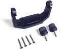
Humminbird GM H5The Humminbird GM H5 Gimball Mount is designed to fit Humminbird HELIX 5 Series fishfinder units. This easy to install mounting bracket kit will hold your HELIX 5 Series unit steady all day long and i... |
||
|
|
|||
|
|||

|
Humminbird Helix 7 Series Protective CoverThe Humminbird Helix 7 Series protective cover is a must have accessory for your Helix 7 unit. It is compatible with all Helix 7 Series fishfinder models. The case protects the lens during storage an... |
||
|
|
|||
|
|||
Cmor Mapping South California For Simrad
Southern California for SimradSEE IT. DIVE IT. FISH IT.CMOR Mapping’s game-changing, high-resolution bathymetric imagery for Simrad, Lowrance, B & G, and Raymarine chartplotters and Mercury VesselView displays brings the ocean floor into an entirely new level of focus for anglers and divers.COMPLETE COVERAGECMOR Mapping data comes from methodical surveys of the entire bottom with high-resolution echosounders — not point soundings and historical records.UNPRECEDENTED DETAILWith resolution as high as 1 meter — meaning each pixel equals a square meter of bottom — we show you every ledge, coral head, and sunken culvert in unprecedented detail.SEAMLESS COMPATIBILITYJust insert a CMOR Mapping card into your plotter and zoom in to see bathymetric imagery. Your vessel icon shows your exact location relative to bottom features.
Manufacturer CMOR Mapping
Mfg No SOCA001S
SKU 6134890
UPC 850001904391



| 0 | Total: $0.00 |

|