Fishing Maps and Charts at LG Outdoors
Buy Fishing Maps and Charts
|
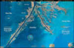
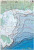
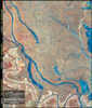
Standard Laminated Map Down River Md#: M00124” X 36” Full Color Aerial Photo Maps Are Laminated. |
||||||
|
|
|||||||
|
PRICE $17.60
QTY
|
|||||||
|
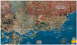
Standard Laminated Map Delacroix Island Md#: M00224” X 36” Full Color Aerial Photo Maps Are Laminated. |
||||||
|
|
|||||||
|
PRICE $17.60
QTY
|
|||||||
|
Standard Laminated Map Lower Pearl River Md#: M01224” X 36” Full Color Aerial Photo Maps Are Laminated. |
||||||
|
|
|||||||
|
PRICE $17.60
QTY
|
|||||||
|
Standard Laminated Map Bayou Dularge Md#: M02024” X 36” Full Color Aerial Photo Maps Are Laminated. |
||||||
|
|
|||||||
|
PRICE $17.60
QTY
|
|||||||
|
Standard Laminated Map Chandeleur Block & Rig Chart Md#: M02624” X 36” Full Color Aerial Photo Maps Are Laminated. |
||||||
|
|
|||||||
|
PRICE $17.60
QTY
|
|||||||
|
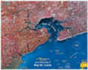
Standard Laminated Map Bay St. Louis Md#: M03924” X 36” Full Color Aerial Photo Maps Are Laminated. |
||||||
|
|
|||||||
|
PRICE $17.60
QTY
|
|||||||

|
Standard Laminated Map Lafitte/Barataria Md#: M04024” X 36” Full Color Aerial Photo Maps Are Laminated. |
||||||
|
|
|||||||
|
PRICE $17.60
QTY
|
|||||||

|
Standard Laminated Map Breton Sound & Delacroix Island Md#: M04724” X 36” Full Color Aerial Photo Maps Are Laminated. |
||||||
|
|
|||||||
|
PRICE $17.60
QTY
|
|||||||
|
Standard Laminated Map La Marsh/Bayou Biloxi Md#: M05024” X 36” Full Color Aerial Photo Maps Are Laminated. |
||||||
|
|
|||||||
|
PRICE $17.60
QTY
|
|||||||
|
Standard Laminated Map Des Allemands/Lake Bouef Md#: M04824” X 36” Full Color Aerial Photo Maps Are Laminated. |
||||||
|
|
|||||||
|
PRICE $17.60
QTY
|
|||||||
|
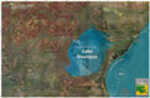
Standard Laminated Map Lake Maurepas Md#: M04924” X 36” Full Color Aerial Photo Maps Are Laminated. |
||||||
|
|
|||||||
|
PRICE $17.60
QTY
|
|||||||
|
Standard Laminated Map Timbalier Island Md#: M03824” X 36” Full Color Aerial Photo Maps Are Laminated. |
||||||
|
|
|||||||
|
PRICE $17.60
QTY
|
|||||||
|
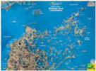
Standard Laminated Map Calcasieu Lake24” X 36” Full Color Aerial Photo Maps Are Laminated. |
||||||
|
|
|||||||
|
PRICE $17.60
QTY
|
|||||||
|
Standard Laminated Map Vermillion Bay Md#: M05524” X 36” Full Color Aerial Photo Maps Are Laminated. |
||||||
|
|
|||||||
|
PRICE $17.60
QTY
|
|||||||
|
|
Standard Laminated Map Lake Borgne Md#: M05824” X 36” Full Color Aerial Photo Maps Are Laminated. |
||||||
|
|
|||||||
|
PRICE $17.60
QTY
|
|||||||
|
Standard Laminated Map Atchafalaya / Morgan City Md#: M04124” X 36” Full Color Aerial Photo Maps Are Laminated. |
||||||
|
|
|||||||
|
PRICE $17.60
QTY
|
|||||||
|
Standard Laminated Map Port Sulphur To Buras Md#: M04224” X 36” Full Color Aerial Photo Maps Are Laminated. |
||||||
|
|
|||||||
|
PRICE $17.60
QTY
|
|||||||
|
Standard Laminated Map Buras/Venice Md#: M04324” X 36” Full Color Aerial Photo Maps Are Laminated. |
||||||
|
|
|||||||
|
PRICE $17.60
QTY
|
|||||||
|
Standard Laminated Map Grand Isle/Fourchon To 4 Bayou Md#: M04424” X 36” Full Color Aerial Photo Maps Are Laminated. |
||||||
|
|
|||||||
|
PRICE $17.60
QTY
|
|||||||
|
Standard Laminated Map Point Au Chein Md#: M02824” X 36” Full Color Aerial Photo Maps Are Laminated. |
||||||
|
|
|||||||
|
PRICE $17.60
QTY
|
|||||||

|
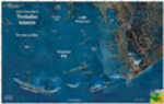
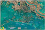
Map Galveston Bay Model: F102A waterproof inshore saltwater two-sided fishing map of the Galveston Bay area. This map is a very detailed, two-sided fishing map of Trinity Bay, West Bay, Clear Lake, Dickinson Bay, Moses Lake, San ... |
||||||
|
|
|||||||
|
PRICE $15.22
QTY
|
|||||||

|
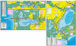
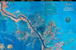
Hook-N-Line Map Upper Laguna Madre Model: F116An inshore two-sided saltwater fishing map that includes the Upper Laguna Madre, Corpus Christi Bay, Nueces Bay, Rockport, Aransas Bay, Copano Bay, and San Antonio Bay. This large system of bays is th... |
||||||
|
|
|||||||
|
PRICE $15.22
QTY
|
|||||||

|
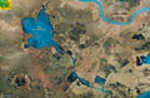
Map Lake Somerville Model: F122Lake Somerville is a medium size freshwater lake located midway between Austin and Houston and about 10 miles north of Highway 290. This is an easy lake to fish and is bordered by seven state and fede... |
||||||
|
|
|||||||
|
PRICE $15.22
QTY
|
|||||||

|
Map Mesqute/san Antonio Model: F134This two-sided saltwater bay map is devoted to the shallow water fisherman. This map shows a "zoomed in" very detailed layout of all the fishing areas. The waters east of the Rockport area abound with... |
||||||
|
|
|||||||
|
PRICE $15.22
QTY
|
|||||||
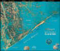
|
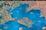
Map Espiritu Santo Bay Model: F135An inshore saltwater two-sided fishing map of the large bay below Port O'Connor, Texas. The coverage area goes from Port O'Connor west to South San Antonio Bay. Map F135 details many reefs, wade fishi... |
||||||
|
|
|||||||
|
PRICE $15.22
QTY
|
|||||||


